The Essex Way,

No this blog has nothing to do with that c**p TV show or a new diet regime but the long distance footpath running for 81 miles from Epping on the outskirts of London to Harwich on the mouth of the Stour river, the initial plan this week was to walk the whole of the route but due to unforeseen circumstances I was only able to do a small section, in this case Harwich to Manningtree, a distance of about 12 miles or 20 kilometres.Because the route was established in the 1970s when car ownership was still relatively low the route was established around the availability of good public transport (remember that?!) which is why the route starts at Epping tube station and finishes opposite Harwich town railway station.
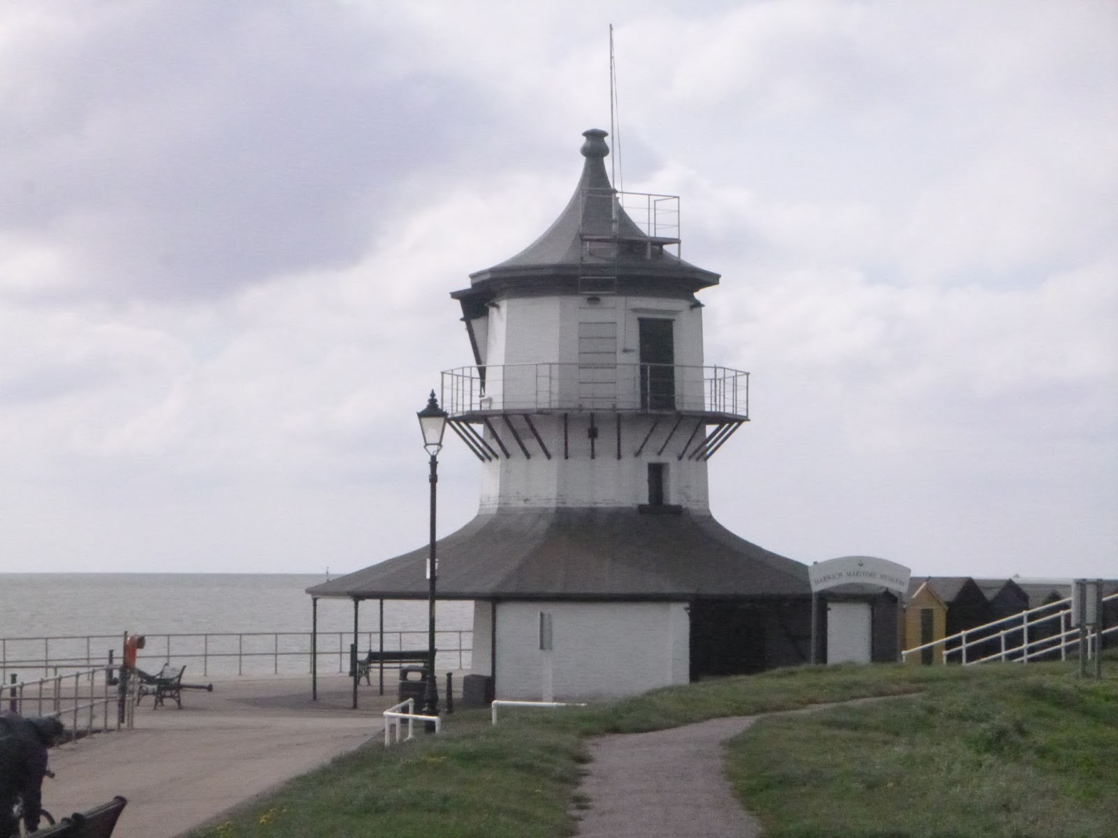
I looked at the train times the day before and decided to catch the 09.04 to Harwich Town, I'd also downloaded the run keeper app to keep track of time and distance and see how accurate my estimations were, with the very basics packed in my bag (waterproof, warm jacket, water, map, penknife, sunscreen, some food, phone, basic first aid kit and emergency charger) I headed down to the station, the local train station is unmanned and doesn`t have a ticket machine meaning that all tickets need to be bought on the train, this is where I scored a massive bonus, the guard never came round meaning a free train ride for me! I arrived at Harwich town just after 9.30 walked to the lighthouse marking the start of the Essex way and set up my phone took a few photos and started walking.
Beach Huts

WW2 Gun Emplacement

Lighthouse

thankfully this didn`t last that long and I was soon onto the dyke that over looked an expanse of marshland and protect the lower lying parts of Dovercourt from flooding. I couldn`t help thinking whether this area was once used by smugglers but given the proximity of Harwich probably not.
It took about an half an hour to cross the marshlands and regain the high ground heading towards Ramsey church, at one time the route took you past the church but now it takes a slightly different route and heads straight for the A120, with this crossed I headed into the village of Ramsey and made for the windmill at the top of the hill. restored on the outside but without sails

after a few kilometres of open farmland I reached the next area of significance, Wrabness woods and specifically Copperas Woods this would lead me back down to the shoreline of the Stour estuary where I would follow it for a few kilometres before heading back up hill and inland past Wrabness church with its temporary (from the 17th century!) bell cage.
Bell Cage

just after the church the footpath becomes hemmed in by hedges on either side, at least you cant lose you way along this section, after a another short section of farmland the longest sustained uphill section was reached and followed into the village of Bradfield where the major temptation of the day lay, the Strangers Home pub, to have a swift pint or not?
Pint or no pint?

with only a couple of miles left to go I decided not to, after all it would only mess up my timings, more farmland had to be crossed before crossing the final road and heading towards furze hill where my walk would end.
Walks end (for now)

the walk had covered 12 miles or 19 kilometres and had taken 4 hours 4 minutes giving an average speed of 3 miles or 4.8 kilometres an hour, not a fast pace but not a bad one either based on this and by my rough (very rough) maths I would have to cover 27 miles a day to do the whole route in 3 days, possible but quite tiring which is why I would recommend anyone contemplating doing the route to take 4 days and try to average 20 miles a day, I would recommend anyone thinking of trying long distance footpath walking to start with something like the Essex way as a good introduction, its not too difficult, well signposted and with useable public transport at both ends.what would I change? although I had sunscreen with me I would definitely take my hat with as the sunscreen wasn't enough and I still ended up with a sunburnt neck.
Follow the link below to go to the Lone Wolf Mobile Bushcraft website.
www.lwbcfs.com
Sounds like you had a good day! Love the photos :)
ReplyDelete